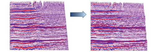
Geophysical information goes through the full cycle of standard and advanced processing of seismic data 2D/3D/3C/4D/4C/VSP on land and at sea of any complexity.
GEOTEK processes and interprets information through an extensive network of processing centers and departments for geological and geophysical data. These centers are part of geophysical companies located throughout Russia and the CIS (Moscow, Tyumen, Tomsk, Krasnoyarsk, Naryan-Mar, Orenburg, Khanty-Mansiysk, Ukhta, St. Petersburg, pos. Boguchany and Almaty).
More than 400 qualified and experienced specialists are employed in these centers (geologists, geophysicists, engineers and IT specialists) that provide comprehensive geological and geophysical data processing and interpretation for the geological modeling of oil and gas fields. Centre specialists provide the full range of data processing, which includes:
Time Processing
- 2D/3D onshore, offshore and transition zone data processing;
- Processing of the large volume of data;
- Processing with relative amplitude preservation;
- Unique algorithms for noise attenuation including adaptive subtraction;
- Correcting long-wavelength traveltime distortion in the presence of inhomogeneous shallow parts of sections using CIP-tomo, a unique practice developed by WesternGeco company;
- Advanced technologies of multiple attenuation using the model approach - GSMP (Generalized Surface Multiple Prediction) for marine data and XIMP (Extended Internal Multiple Prediction) for land data.
Depth processing
- Different algorithms of transitional transformations to pre-stack depth imaging (Kirchhoff, WEM, Gaussian Beam, RTM);
- A unique CIP-Tomo tomography algorithm (WesternGeco) used for velocity-depth modeling in the most difficult of environments;
- 2D data depth transition used for unique velocity-depth modeling
Specialised Processing
- AVO-analysis;
- Time and depth processing, taking into account azimuthal anisotropy, VTI and TTI;
- 5D COMFI – data regularity adjusted for ray azimuth;
- Borehole data used during the early processing stages (Well-Driven Seismic) to guarantee that the reliability of the acoustic and AVA/AVO inversion of the seismic data are closest to the real value.
